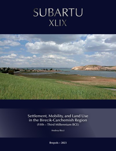
Settlement, Mobility, and Land Use in the Birecik-Carchemish Region
(Fifth–Third Millennium BCE)
Andrea Ricci
- Pages: xvi + 384 p.
- Size:216 x 280 mm
- Illustrations:227 b/w, 22 col., 10 tables b/w., 14 maps b/w, 25 maps color
- Language(s):English
- Publication Year:2023
- € 90,00 EXCL. VAT RETAIL PRICE
- ISBN: 978-2-503-55508-9
- Paperback
- Available
- € 90,00 EXCL. VAT RETAIL PRICE
- ISBN: 978-2-503-60483-1
- E-book
- Available
Andrea Ricci is a researcher and scientific coordinator at Kiel University (Germany). He is a landscape archaeologist specialist in reconstructing cultural landscapes formation processes of Southwestern Asia on a long term perspective
This volume investigates settlement trajectories and systems of movement in the Birecik-Carchemish sector of the Euphrates River Valley from the fifth to the third millennium BCE. Integrating remote sensing analyses, published data of individual surveys and excavations, and the original results of the ‘Land of Carchemish Project’, this multi-scalar study shows the significant longevity of settlement choices and the role of small sites in shaping the cultural landscape of the region, both along the Euphrates and in the uplands. Attention is paid to the dynamics behind settlement creation and continuity, while the author also provides a reassessment of the radiocarbon dates from sites in the area of study.
List of Illustrations
Preface and Acknowledgments
1. Introduction
The Geographical and Archaeological Context
Data Sources
Aims and the Structure of this Book
2. History of Research
Early Travellers and First Excavations
First Formal Excavations
Geoarchaeological Investigations of the 1970s
Rescue Surveys and Salvage Excavations
The Twenty-First Century
3. Geographical and Environmental Setting
A Geographic Introduction
Land Use and Modern Environmental Conditions
Palaeoclimatic Conditions
4. Methods and Techniques of Investigation
Data Recovery Before Fieldwork: Remote Sensing and Cartography
The LANDSAT Program
CORONA Keyhole (KH) Project
Google Earth
The GeoEye-1 Project
The Shuttle Radar Topography Mission (SRTM)
Maps
The Use of Remote Sensing Data
Data Recovery in the Field
Algaze Survey (AS)
Karul and Özdoğan Survey (KOS)
The Moore and the Sanlaville-Copeland Surveys
The McClellan and Porter Survey
The Land of Carchemish Project (LCP)
Data Recovery in the Field: An Overview
Data Integration and Management
5. Chronological Framework
Pottery Assemblages from the main Excavated Sequences
Horum Höyük (AS 10)
Hacınebi (AS 28)
Zeytinli Bahçe (AS 44)
Yarım Höyük (AS 50)
Jerablus Tahtani (LCP 22)
Shiukh Fawqani (EBSE 1)
Shiukh Tahtani (EBSE 2)
Tell Amarna (LCP 21)
Tell al-‘Abr (EBSE 5)
Tell Ahmar (EBSE 6)
The Radiocarbon Dates
Horum Höyük (AS 10)
Tilbeş Höyük (AS 14)
Hacınebi (AS 28)
Zeytinli Bahçe (AS 44)
Yarım Höyük (AS 50)
Jerablus Tahtani (LCP 22)
Shiukh Fawqani (EBSE 1)
Shiukh Tahtani (EBSE 2)
Tell al-‘Abr (EBSE 5)
Overview of the Survey Ceramic Types and Absolute Dates
The Ubaid Period
The Late Chalcolithic Period
The Early Bronze Age (EBA)
Overall Chronological Scheme
6. Settlement Dynamics in the Birecik-Carchemish Region from the Ubaid to the LEBA Period
The Ubaid Occupation
The Late Chalcolithic Period
The Local Late Chalcolithic Occupation (LC 1–2 and LC 3)
The Middle and Late Uruk Occupation (LC 4 and LC 5)
The Early Bronze Age Period
The EEBA Occupation
The MEBA Occupation
The LEBA Occupation
General Settlement Trends in the Birecik-Carchemish Region
The Case of Tell Jerablus Tahtani (LCP 22) and its Surroundings
7. Discussion
Settlement Stability and Small Nucleated Communities
The Role of the Euphrates and Systems of Movements
Localizing the Global: Towards a Regional Contextualization of the Uruk Phenomenon
A ‘Second Urban Revolution’ within Increasing Intra- and Inter-regional Competition?
8. Concluding Remarks
Scales of Analysis and the Birecik-Carchemish Landscape through Time
Future Research Directions
Towards Integrated High-Resolution Regional Landscape Studies
Works Cited
Appendix A. Site Gazetteer
Appendix B. Pottery Catalogue
Notes
Index
