The Early Christian Monuments of Ravenna
DISCOUNT PRICE
View publication
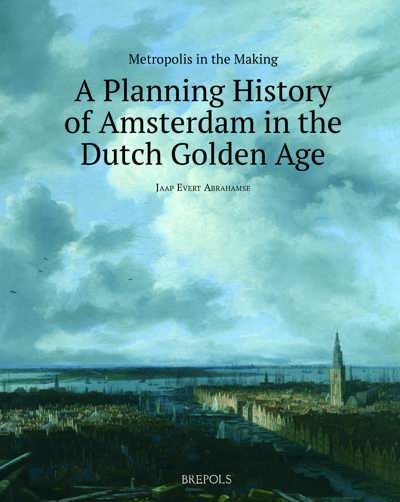
Early modern Amsterdam was an ultra-modern city, laid out conforming to the triple demand of functionality, beauty and profit; a city that takes a unique place in European urban history because of its location, design, and impressive scale. Making of a Metropolis tells the story of Amsterdam becoming one of the largest cities in Europe in the seventeenth century. Amsterdam was one of the cradles of capitalism, but at the same time one of the most meticulously planned cities in the world.
"Abrahamse has produced a most interesting tome based on archival documents, and has rounded out much of the existing literature on the subject. It is a beautifully organised and illustrated book, a most worthwhile read." (Nicola Boothby, in Maps in History, No 69, January 2021, p. 6)
“Never before has this story been told in such a well-documented and coherently-structured way. Readers who already know their way around ‘the most meticulously planned city of Europe’ will have an advantage compared with those who have never visited Amsterdam. But even those who know the city at first hand will find their knowledge enlarged in an astonishing way.” (Reinder Storm, in Imago Mundi, 73/2, 2021, p. 257-258)
"For its comprehensiveness and breadth of scope, this work will undoubtedly become an indispensable aid to scholars of Northern European urban, economic, and social history." (Elisabeth Berry Drago, in Renaissance Quarterly, 76/4, 2023, p. 1510
Jaap Evert Abrahamse studied History of architecture and urban planning at the University of Groningen, the Netherlands. His graduation placement was at the Atelier parisien d’urbanisme (APUR), where he worked out the basics of a master’s thesis on post-war urban reconstruction projects in Paris. After graduation, he worked as a researcher for the planning department of the City of Amsterdam and as a lecturer of Architectural and urban history at Utrecht University and the Amsterdam Academy of Architecture.
He received his doctorate with honours in 2010 for a thesis about Amsterdam’s development in the Dutch Golden Age. For his thesis he was awarded a study prize of the Praemium Erasmianum Foundation.
Since 2007, he has been working as a senior researcher for the landscape department of the Cultural Heritage Agency of the Netherlands, regularly publishing and lecturing on the history of architecture, urban planning, infrastructure, and landscape. With Reinout Rutte, he wrote the Atlas of the Dutch Urban Landscape. A Millennium of Spatial Development, a comparative long-term overview of the urbanization pattern, urban planning, and urban practice in the Netherlands, both from a Dutch and a European perspective.
After the Fall of Antwerp in 1585, Amsterdam took over its position as the central trade hub in northwestern Europe and grew rapidly to become one of Europesurge in trade and industry went hand in hand with an explosive growth of Amsterdam, in 1613 and 1663 respectively, which increased the surface area of the city fivefold. Around the old town, the famous ring of canals was constructed. Beyond this residential district, mixed-use and industrial zones were laid out, while the construction of new harbour islands resulted in a five-kilometre waterfront along the borders of the IJ, the sea-branch that connected Amsterdam to the rest of the world.
In the Dutch Golden Age, Amsterdam became an extraordinarily modern city, laid out in accordance with the trifold demand for functionality, beauty, and profit. It thus occupies a unique place in planning history because of its location, design, and impressive scale. This book examines how the administrative bodies of Amsterdam managed to undertake and complete these immense projects from the viewpoints of urban design, infrastructure, water management, logistics, and finance.
The first part of this study is dedicated to the extension projects. A thorough analysis of extant administrative archives and numerous cartographic documents has enabled the author to reconstruct the decision-making process concerning the scale, design, and realization of the extensions. The second part examines in detail the use of the land, public space, and water management. Metropolis in the Making tells the story of one of the most meticulously planned cities in the world, and reveals how Amsterdam thus became, among many other things, a significant cradle of early modern capitalism and urbanism.
Chapter 1. Introduction
1.1 The Age of Amsterdam
1.2 ‘Amstelodamum urbs Hollandiae primaria, emporium totium Europae’
1.3 The Versailles of the north
1.4 The cult of geometry: Amsterdam as the ideal city
1.5 The notion of pragmatism
1.6 Scope and set-up of this book
1.7 Methodology and material: resolutions, regulations, reports, and requests
1.8 The city government and its archives
PART I: THE DEVELOPMENT OF THE URBAN STRUCTURE
Chapter 2. Urban development 1600-1650: the third extension
2.1 The build-up to the extension project 1600-1609
2.1.1 Introduction: the effects of the population explosion
2.1.2 ‘The most secure and inexpensive’. The difficult realization of the Zuiderkerk
2.1.3 The Stock Exchange project
2.1.4 The 1609 authorization for urban extension
2.2 The design phase 1610-1611
2.2.1 The first designs for the extension
2.2.2 Conflict with Rijnland
2.2.3 The fortification plan: prince Maurice as an engineer
2.3 The realization phase 1611-1613
2.3.1 The beginning of the works
2.3.2 A city out of control: suburban development
2.3.3 An unsolvable problem
2.3.4 Staets’s plan goes out with the trash
2.3.5 The reduction of the extension
2.4 The canal district 1613-1616
2.4.1 From a two-canal to a three-canal plan
2.4.2 The side streets
2.4.3 The brink of ruin
2.4.4 A rush job: the new fortification and the Herengracht
2.4.5 The auction of building lands
2.4.6 Quay walls, bridges and water levels
2.4.7 More side streets?
2.4.8 Damages due to planning: complaints against the fifth street
2.4.9 A grand boulevard in Amsterdam?
2.4.10 The Keizersgracht and the Prinsengracht
2.4.11 Another side street?
2.5 Mass migration: the demolition and reconstruction of the suburbs 1613-1620
2.5.1 The impecunious
2.5.2 Financial aid for everyone
2.5.3 ‘Quiet, unity, order and police’
2.5.4 The Jordaan quarter: from grand design to urban puzzle
2.6 Churches and towers 1616-1640
2.6.1 Clock towers for the new city
2.6.2 The church and tower on Westermarkt
2.6.3 The Noordermarkt and the Noorderkerk
2.6.4 Graveyards
2.6.5 A clock for the Haarlemmerpoort gate
2.7 Western islands 1610-1640
2.7.1 The speculators
2.7.2 ‘Fathers and foster parents’. The position of Cornelis Pietersz Hooft
2.7.3 Prinseneiland and Bickerseiland: ‘disproportion and deformity’
2.7.4 The Realeneiland
2.7.5 The speculators taking over: the occupation of the Bickerseiland and Prinseneiland
2.8 The Haarlemmerdijk district 1610-1620
2.8.1 Dikes and locks: traffic and water management
2.8.2 A new slum
2.8.3 The Haarlemmer Houttuinen (‘Harlem timberyards’)
2.8.4 Three squares
2.9 Urban development after the third extension 1620-1650
2.9.1 ‘An almost never-ending task’: the administrative legacy of the extension project
2.9.2 Building in the extension: Northerners in Amsterdam
2.9.3 Land reclamation and redevelopment
2.9.4 The Nieuwe Doelenstraat
2.9.5 Handboogstraat and Voetboogstraat: redevelopment of more shooting ranges
2.9.6 The city’s defence in times of distress
2.9.7 Defence and harbour extensions: Rijsenhoofd and Waalseiland
2.9.8 The on-going urbanization of Amsterdam’s periphery
2.9.9 The inescapable suburbs
Chapter 3. Urban development 1650-1700: The fourth extension
3.1 Extension plans 1650-1660
3.1.1 Choosing the right moment
3.1.2 The Stadtholder’s attack on Amsterdam
3.1.3 Jan Heijmansz Coeck and the defence of Amsterdam
3.1.4 ‘Lightnings of War’: the construction and demolition of the ‘block houses’ in the Amstel
3.1.5 The 1652 Coeck plan: start and stop of the extension project
3.1.6 Intermezzo. The Nieuwe Kerk, the town hall and the First Anglo-Dutch War
3.2 The eastern harbour islands 1652-1660
3.2.1 Fleet strength and harbour extension
3.2.2 The transformation of the island of Kattenburg
3.2.3 Wittenburg
3.2.4 Oostenburg
3.2.5 The Nieuwe Vaart and Rapenburgergracht canals
3.3 Fortification works: stagnation, progress, completion 1654-1700
3.3.1 Reducing ambitions
3.3.2 New plans
3.3.3 More preparations for the fortification: the carpenter’s yard and the Oosterbeer dam
3.3.4 Relocation of mills and ropeyards
3.3.5 The Hogesluis: ‘Amsterdam’s major bridge’
3.3.6 The design and construction of four city gates
3.3.7 The realization of the fortification: strategic priorities
3.3.8 Progress at breakneck speed
3.3.9 State of defence ‘completely enclosed’
3.3.10 The defence of Amsterdam and the Second Anglo-Dutch War
3.4 Designing the street plan 1660-1662
3.4.1 ‘Five distinct concepts’
3.4.2 The city and the river: the Amstel as the central axis
3.4.3 The approbation of the plan
3.4.4 The set-up of the ‘golden bend’ in the Herengracht
3.4.5 The continuation of the canal district
3.4.6 Working space outside the Prinsengracht
3.5 Towards a tabula rasa 1662-1670
3.5.1 Wiping out the landscape
3.5.2 A new land policy: the key to success
3.5.3 Value assessment
3.5.4 Demolition
3.5.5 The main arteries
3.6 The realization of the extension project 1663-1670
3.6.1 Weighing insights and interests
3.6.2 Cost control
3.6.3 Earthwork
3.6.4 Sand, clay, refuse
3.6.5 Planning in phases
3.6.6 Digging the Herengracht
3.6.7 Moving the Leidsegracht: industrial estate turned into residential zone
3.6.8 Reguliersgracht or Halvemaanstraat, canal or street?
3.6.9 The Reguliersplein
3.7 Public works after the Year of Disaster 1672-1682
3.7.1 Standstill
3.7.2 The Weesperstraat: high street through the wasteland
3.7.3 The Nieuwe Keizersstraat and Nieuwe Breestraat
3.7.4 The transformation of Rapenburg
3.7.5 The canals east of the Amstel
3.7.6 The creation of the Nieuwe Herengracht
3.7.7 Bridging the Amstel
3.7.8 The sea dike as a structuring element
3.8 Building in the new city 1663-1670
3.8.1 Parcellation and land sales
3.8.2 The right of precedence
3.8.3 Property investment and land speculation
3.8.4 Private building: the search for unity
3.8.5 Collective architecture
3.8.6 Blocks and plots
3.8.7 The city and the river
3.8.8 The planning and realization of churches
3.8.9 Two orphanages
3.8.10 ‘After the current fashion’: building regulations and architecture
3.9 The end of urban development 1670-1690
3.9.1 ‘Life in the walls’: the troublesome state of Amsterdam’s defence
3.9.2 The planning of Amsterdam’s periphery
3.9.3 The Eternal Suburb
3.9.4 The atlas of illegal buildings
3.9.5 The ‘Plantation’: the end of city development
3.10 Conclusion: the development of urbanism
3.10.1 The third extension: the dissolving of the grand design
3.10.2 The fourth extension: urbanism as science
PART II: THE FUNCTIONING OF AMSTERDAM
Chapter 4. ‘Freedom of trade and activity’: land-use planning in the seventeenth century
4.1 Introduction: ‘The constitution of this city’
4.2 The canal district: Amsterdam as a residential city
4.2.1 Building regulations for the canal district
4.2.2 ‘Great filth’: the functioning of the canals
4.2.3 The fourth extension: Canal District 2.0
4.2.4 The gold leather factories: pre-urban industry in the canal district
4.3 The outer ring: working space in Amsterdam
4.3.1 The Jordaan district
4.3.2 The working areas in the fourth extension: Leidsebuurt, Weteringbuurt, Weversbuurt, Weesperbuurt
4.3.3 The old and the new tannery district
4.3.4 Chemical industry: saltpetre, sulphur, vermillion, and turpentine
4.3.5 Promotion of the drapery: housing for industry
4.3.6 Brandy Island: the rise and fall of the Amsterdam distillery district
4.4 The transformation of the old centre: zoning and spatial policy
4.4.1 The edge of the canal district: the King’s Canal
4.4.2 Environmental regulations for ‘the middle and the best part of this city’
4.4.3 The herring industry and the tar trade: industrial activity removed from the view
4.4.4 The planning monopoly: the prohibition of parcellation
4.5 The urban periphery
4.5.1 An industrial landscape
4.5.2 The sawmill park
4.5.3 The textile industry
4.5.4 Powder mills
4.5.5 The pesthouse
4.5.6 Ink production
4.6 Conclusion: Amsterdam’s functional profile
Chapter 5. ‘Some public places’: traffic, infrastructure and public space in seventeenth-century Amsterdam
5.1 Introduction: the infrastructural machine
5.2 City of flows: traffic in Amsterdam
5.2.1 A city flooded by traffic
5.2.2 Comfort and status: carriages and pleasure yachts
5.2.3 ‘Packed, blocked and obstructed’: timber rafts and timber docks
5.2.4 Construction traffic
5.2.5 Retail and market trade
5.2.6 Traffic regulations: speed limits and one-way traffic
5.3 Urban infrastructure
5.3.1 The development of the traffic system
5.3.2 From private to public space
5.3.3 Wharves and quays; land traffic through a water city
5.3.4 Controlling the alignments
5.3.5 Straight and crooked streets
5.3.6 Heavy traffic in little space
5.3.7 Functional planning: residential canals, working canals and shopping streets
5.3.8 Ferry ports, beer quays, markets, sand barges: the need for busyness
5.3.9 The first ring-road around Amsterdam
5.3.10 Squares
5.3.11 The Dam Square and the Nieuwmarkt
5.3.12 Church squares, waggon squares and outer squares in the seventeenth-century extensions
5.3.13 ‘Passage and hauling’: the accessibility of Dam Square
5.3.14 Vaulted waterways towards Dam Square
5.4 The layout of urban space
5.4.1 Public and private space
5.4.2 Paving the streets
5.4.3 Street names
5.4.4 Bridges
5.4.5 A Rialto Bridge for Amsterdam?
5.4.6 Timber and stone bridges
5.4.7 Quays
5.4.8 Decay and repair; and a plan for filling in the Burgwallen canals
5.4.9 Public use of private property
5.4.10 Urban forestry: ‘sweet air, adornment and delight’
5.4.11 Street lighting
5.5 Conclusion: from private to public, from timber to stone
Chapter 6. ‘A lovely maiden with bad breath’: the problems of a water city
6.1 ‘The best city of Europe’
6.1.1 A city in the peat. The complexity of the water management system
6.1.2 The uses of the water inside Amsterdam
6.2 Engrained habits: water pollution in Amsterdam
6.2.1 The canals as a waste dump
6.2.2 City cleansing
6.2.3 Toilets and sewers
6.3 The water circulation and the third extension
6.3.1 ‘Pestilential stench’: the water as a source of infection
6.3.2 Dirty-water mills: the project of Cornelis Danckerts de Rij
6.3.3 Danckerts’ plan is criticized
6.3.4 Water from the Vecht, water from Amstelland, water from Rijnland: ‘a strong and continuous movement’
6.4 The fourth extension: further decline of the water quality
6.4.1 Locks in the river Amstel: the definitive solution to Amsterdam’s water problems
6.4.2 ‘Saddening experience’: the effect of the great locks in the Amstel
6.4.3 Horse mills against high water
6.4.4 Muddling on: a repetition of moves
6.5 A losing battle: the problems of water circulation
6.5.1 The maintenance of locks
6.5.2 Sober, competent, and vigilant: the lockkeepers, their supervisors, and their general
6.5.3 Obstacles in the water
6.6 Art and science: other solutions for the water problem
6.6.1 Brewers and contractors
6.6.2 Otto Jeuriaensz, mud tycoon
6.6.3 The failure of Jan de Bray
6.7 The problems of the IJ: pollution, silting up, and flood control
6.7.1 The Nieuwe Vaart
6.7.2 Flood control along the IJ
6.7.3 Higher water, greater plans
6.7.4 ‘Negligence and failure’
6.8 Conclusion: an insoluble problem
Chapter 7. Conclusion. Making the city
7.1 A new city
7.1.1 A city of contrasts
7.1.2 Unity in architecture and townscape
7.2 Functionality, beauty, and profit
7.2.1 The myth of the masterplan
7.2.2 The third extension: an administrative infarct
7.2.3 The fourth extension: the perfect plan?
7.2.4 Amsterdam as enterprise
7.2.5 Place of business: land and zoning policy
Literature
Illustration credits